Available for work and Cooperation

Hello, I am Mohammadmehdi Zare

Urban Planner & Designer| GIS Specialist | BIM Specialist | 3D Visualization Expert

Profile

Featured Work

O2 Interior Design
View Details

Interior design, Revit, Bim, Twinmotion, Sketchup

O2 Interior Design

These interior renderings showcase a modern minimalist space designed with a strong focus on...

Learn More
Meymand Urban Development Master Plan
View Details

Urban Planning, Land Use, Infrastructure

Meymand Urban Development Master Plan

Meymand has long served as the central settlement of its region, functioning as the primary hub for...

Learn More
BIM Residential Building Modeling
View Details

BIM Modeling, Revit, Rendering, Twinmotion

BIM Residential Building Modeling

This rendering showcases a detailed digital model of a two-story residential building created using...

Learn More

About Me

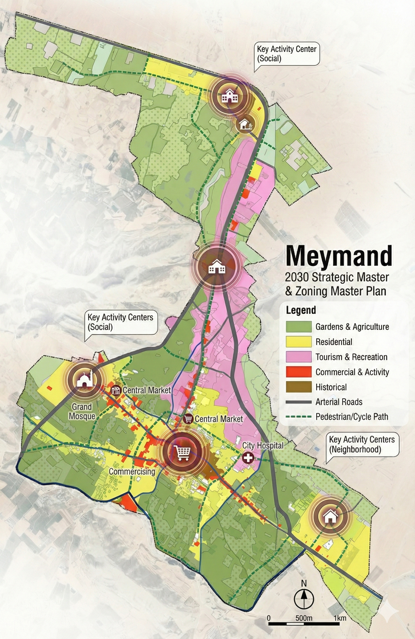
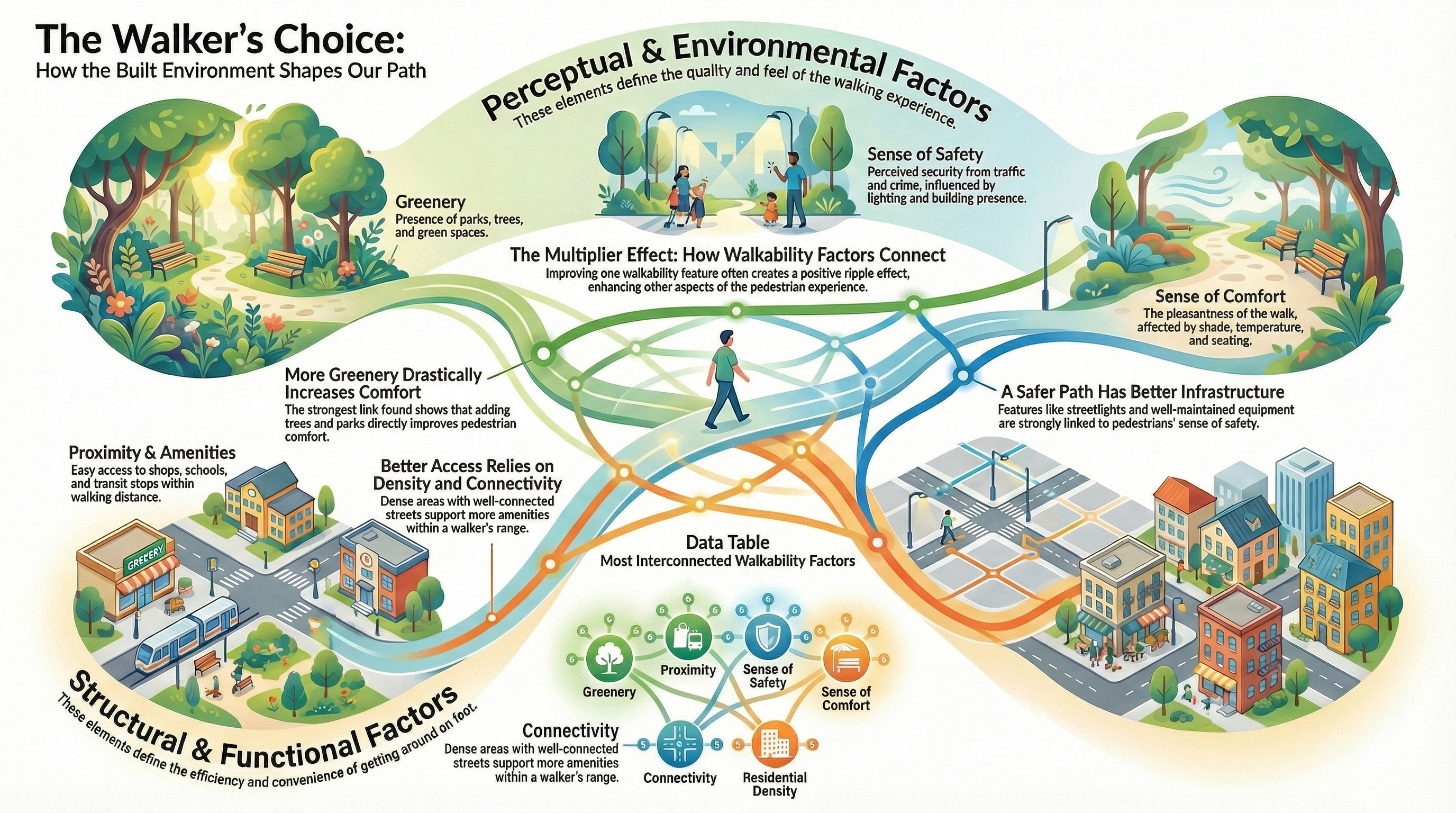
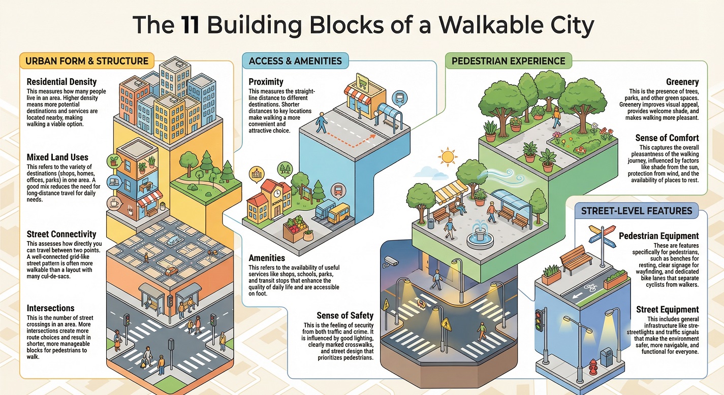
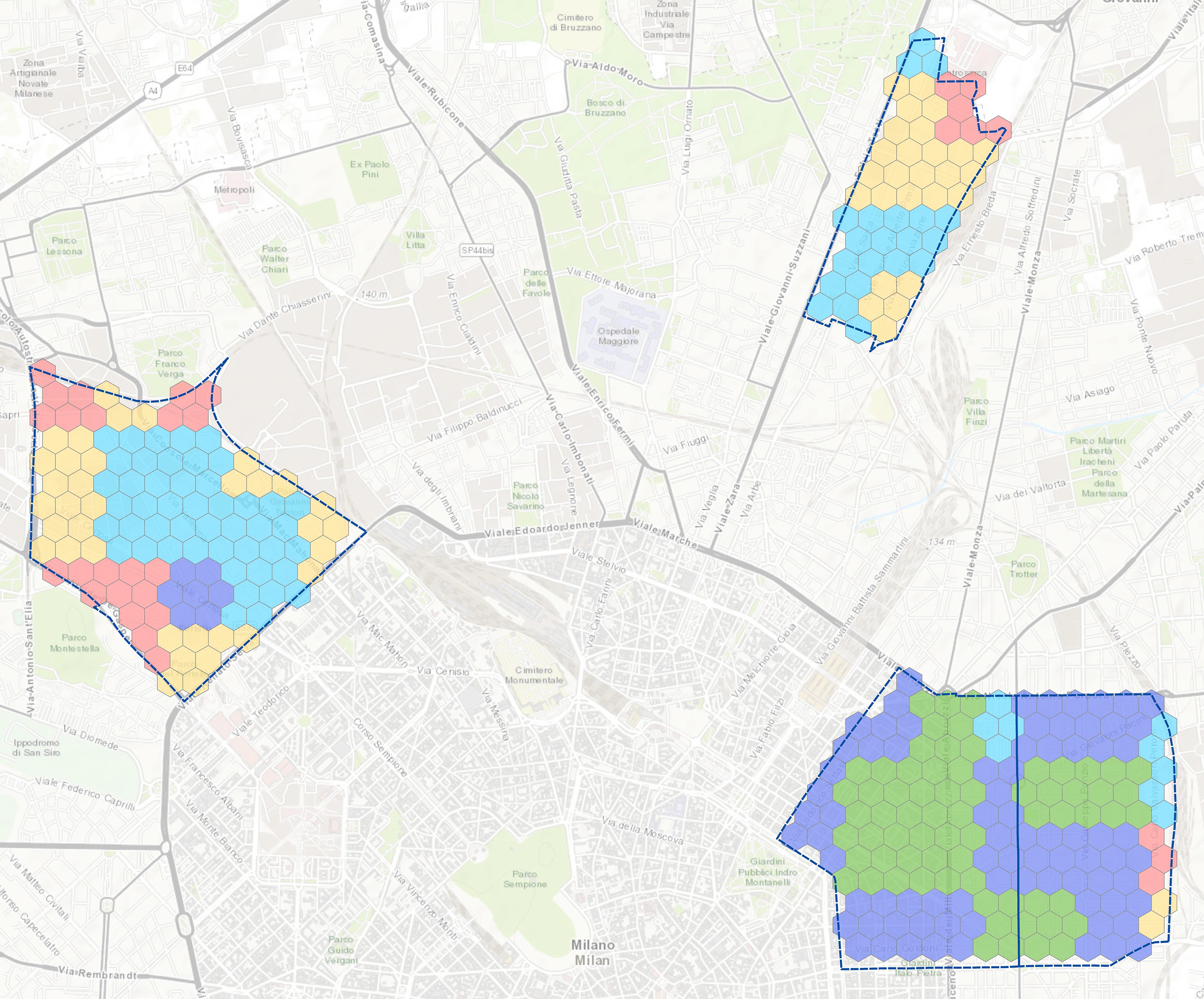
Hello, I’m Mohammadmehdi Zare.  I am an Urban Planner, Urban Designer, and GIS Specialist passionate about bridging the gap between complex spatial data and sustainable urban design. With a strong foundation in data analysis and 3D visualization, I help transform raw geographical information into actionable strategies and immersive visual experiences. My journey in urban planning has taken me from analyzing land use and infrastructure for master plans in the Middle East to researching natural disaster resilience at the Politecnico di Milano. I specialize in using advanced tools such as ArcGIS Pro, CityEngine, and QGIS to solve spatial problems, while leveraging Twinmotion, SketchUp, and Revit to visually bring those solutions to life. Whether I am coding automation scripts in Python or designing a smart city model, my goal remains the same: to create more resilient, efficient, and livable urban environments through the power of technology

Education

Master of Urban Planning and Policy Design
Politecnico di Milano
2021 - 2024
Bachelor of Urban Planning Engineering
Apadana University
2015 - 2019

Technical Skills

ArcGIS Pro / ArcMap 95%
CityEngine 70%
QGIS 90%
AutoCAD / Civil 3D 85%
Twinmotion / V-Ray 85%
Adobe Photoshop 90%
Adobe InDesign 40%
Python 60%
Java 40%
Revit and BIM 70%

Work Experience

Oct 2024 - Jul 2025

Urban Planner and Designer

Naghshavand Consultancy Engineering Company

Conducted comprehensive land use planning for Meymand city. Increased allocation of necessary land uses by 25%. Generated comprehensive databases improving data accessibility by 75%. Contributed to Sadra Development Plan optimizing land use strategies.

Mar 2023 - Jul 2023

GIS Expert

Politecnico di Milano (Internship)

Spatializing natural disaster resilience with GIS and geostatistical techniques in Europe. Managed georeferenced data and generated maps reflecting disaster intensity.

Oct 2018 - Mar 2019

Teaching GIS and Civil3D

Apadana University

Teaching Civil 3D software to students.

Jan 2018 - Sep 2018

GIS Specialist

Parsboom Consulting Engineers

Participation in initial phase of identifying study area. Comprehensive evaluation from urban planning perspective. Analysis of land use, infrastructure, and transportation.

Latest Articles

Let's Work Together

Have a project in mind? I'm always open to discussing new opportunities and ideas.

Mohammadmehdi.zarechogiyaee@mail.polimi.it