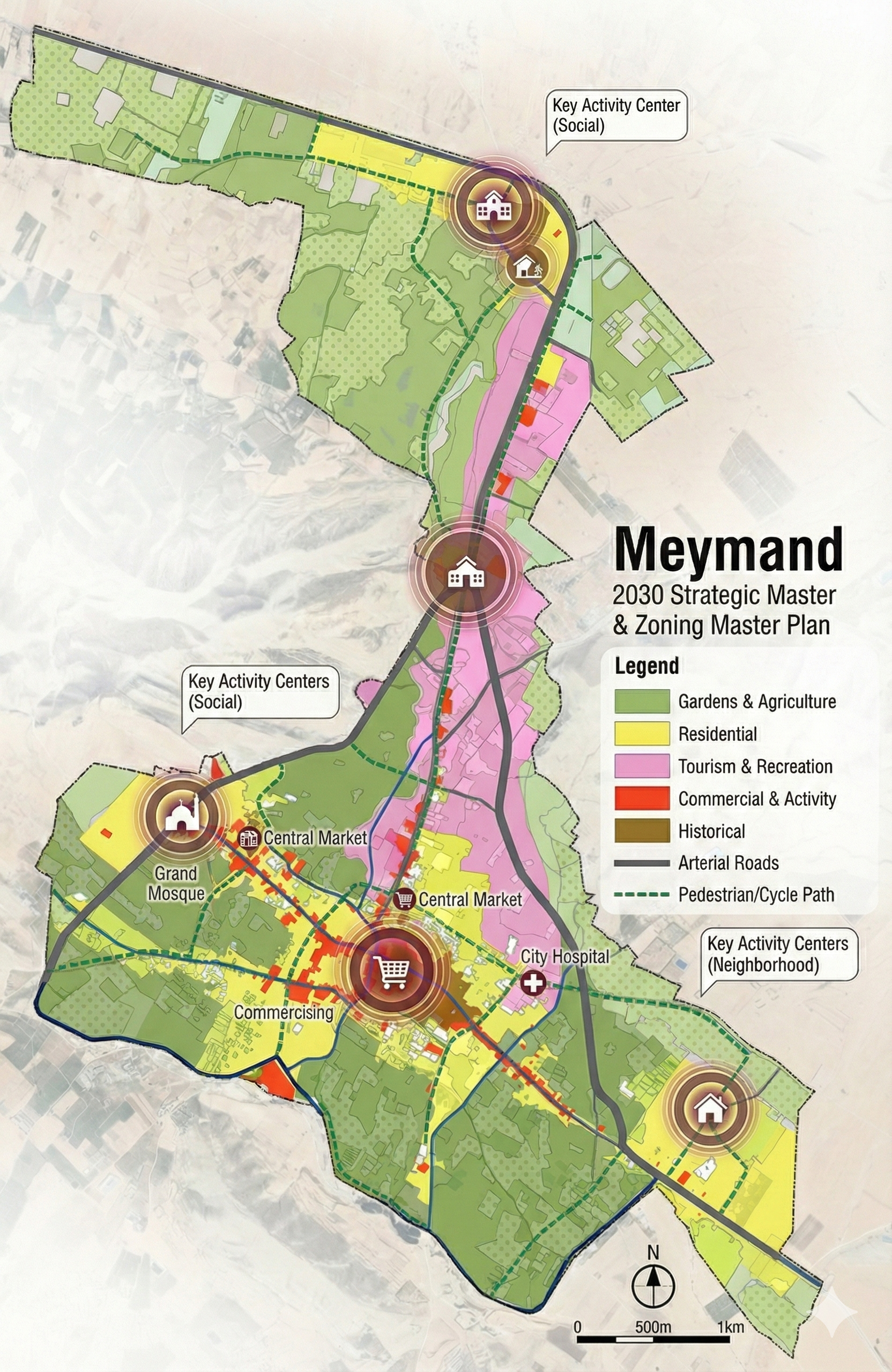
Meymand has long served as the central settlement of its region, functioning as the primary hub for surrounding villages. However, studies revealed significant infrastructural shortages within its sphere of influence. Many smaller settlements were excluded from essential services and facilities due to existing service delivery standards and regulations. Without addressing these deficiencies, population growth over the coming decades would further exacerbate the inefficiencies, leaving even more residents underserved. One of the immediate priorities identified was the creation of a functional road network to strengthen connections between Meymand and its dependent villages. As the central node, Meymand must remain accessible in order to supply the majority of services and meet the needs of the surrounding settlements. Land use planning was positioned at the core of the development strategy. This approach was essential not only to achieve the long-term goals of the project but also because of the strong reciprocal relationship between land use and other urban systems. Effective land use directly influences economic performance, social relations, environmental sustainability, and transport efficiency. At the same time, the success of land use planning relies on the optimal performance of these systems. The planning process drew on both the existing spatial structure of Meymand and the proposals of earlier development frameworks, such as the Hadi Plan, to define new urban criteria. Detailed studies revealed that unplanned and fragmented growth had led to a lack of cohesive spatial organization. The proposed strategy therefore sought to transform Meymand into a structured and organized settlement, capable of providing a higher quality of life for its residents.